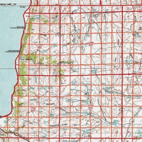
The map shown above is a good exzmple of a public land survey system, or PLSS. The PLSS is a version of a cadastral map. It is a systematic land partitioning system meant to show land ownership in an area and can also offers locational information. The land is divided up into congressional townships, 36 square acre parcels of land, and are bounded by ranges and townships.
No comments:
Post a Comment