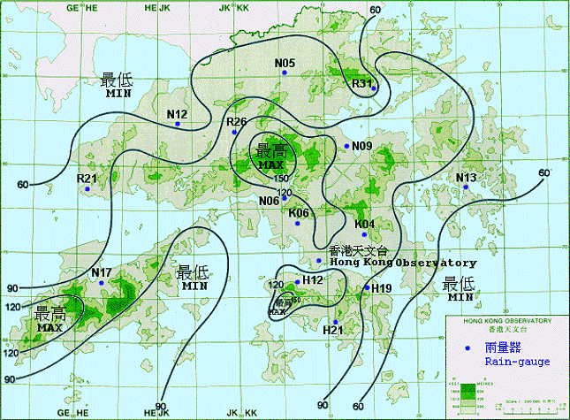
The map shown is an example of a isohyet map. An isohyet map is a type of contour map that shows the levels of rainfall an area receives. This map uses contour lines that, in this case, join areas that receive the same level of rainfall to one another in China. The distance between contour lines defines the rate of change between the two areas. For example, the contour line labeled "90" that wraps around the middle region is at times close to the contour line labeled "60" at the upper region. That means that there is a large change in the amount rainfall over a short distance. The map also uses color; areas that receive more color are a brighter green, while those that receive less rain are a more pale green color.
No comments:
Post a Comment